
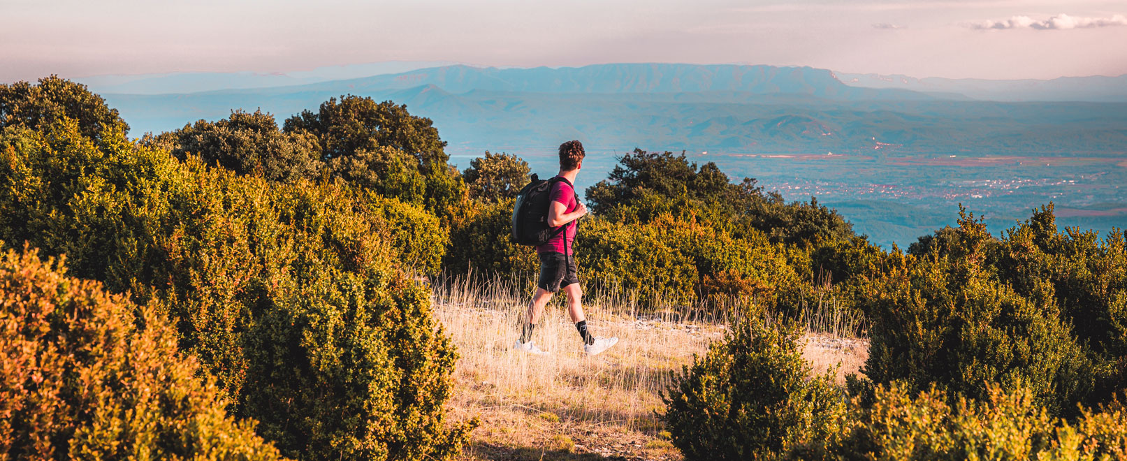
Hiking the south side of the Mourre-Nègre
The Grand Luberon, from the depths of the earth to the summit

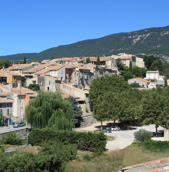
The Luberon Regional Nature Park presents an exceptional diversity of landscapes and geological phenomena and is recognised as a UNESCO Global Geopark. The commune of Cabrières-d’Aigues lies within the perimeter of the geological reserve and is a site that provides a good opportunity to explore the southern slope of the Grand Luberon, from the depths to the paths along the ridge.
In a few hours of walking, we covered thousands of years and scanned the horizon for kilometres! A big breath of fresh air and nature shared with friends at the heart of one of the most emblematic mountain ranges in Provence.
Duration:
6 hours
Type:
Hiking
Voyage to the centre of the earth…
We leave the village by taking the old GR92 which runs alongside agricultural lands heading for the Mourre Nègre massif.
The itinerary then follows the traces of the Cabrières-d’Aigues geological path. This educational approach sheds clear light on where the rocks and reliefs come from, and the type of soil under our feet. So here we are setting off far away, beyond our time!
We discover that a local limestone rock exists, the Molasse de Cucuron, which is rich in marine fossils. The sea covered these lands about 10 million years ago… As for the many pebbles on the ground, they are reminiscent of the old delta of the Durance. Moving on towards the slopes of the Grand Luberon, the configuration of the hills shows the anticline relief of the massif from a convex fold in the earth’s crust.
These lessons in the open air bring back fond memories of learning things in school…

Find out more
Displaying an astonishing collection of fossils, the Geology Museum tells the territory’s long story, set up in the Maison du parc in Apt. The fascinating account of 150 million years.
The footprint of humans

Fall in love…
The earth is again today the source of creation and inspiration. You just have to go into Sylvie and Philippe Duriez’s ceramics workshop, Point Fusion Poterie, to be sure of that…
Memory and heritage
The circuit not only takes us towards the far off origin of the rocks, but it also touches on humans’ most recent uses.
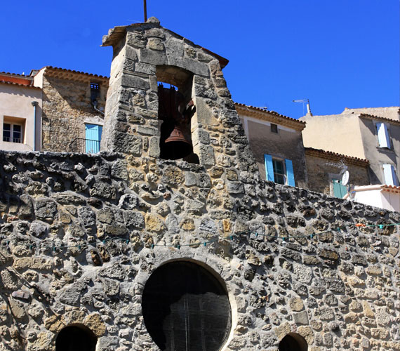
On setting out we lingered in front of one of the village’s fountains. It is cut into the rock, and supplied by a gallery dug into the mollasse that drains the infiltration waters. It’s a surprising system, really well thought out!
Further on, near the Ravin du Règue, the vestiges of an old kiln remain on the edge of a path. The blocks of limestone were placed into this space dug out of the bank and heated to a very high temperature to make lime.
Only achievements and ingenuity…
The climb towards the summits
To the sound of the bells
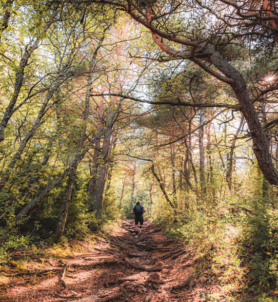
Beyond the hills that run the length of the Grand Luberon, we abandon the geological path on the right to take on the wooded slopes of the massif. As we move through forests and pastureland, the ringing of bells that we can hear far away gets closer. We come across a shepherd, his big white dogs busying themselves around his flock sheep…
The show before us confirms what we’ve read about. Pastoralism is widely encouraged because it plays a vital role in the balance of biodiversity. The sheep do a great job at keeping everything tidy! What’s a more effective way to back up operations keeping overgrowth down? By creating natural firebreak areas, they play a major role in protecting the massif.

Important!
The patous are guard dogs that take their mission seriously! In their eyes, hikers that are too daring can be a threat for the flock… It is better to walk calmly around it.
An exceptional reward!
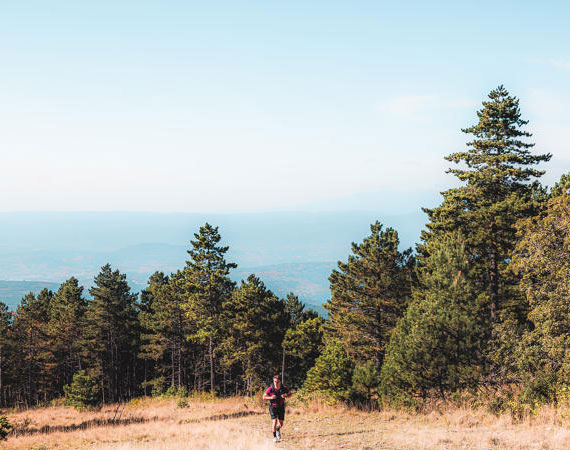
Things start getting serious when we take on the zigzags of the climb! The summits of the Grand Luberon suddenly seem much less rounded to us than they look. We vigorously take on the 400 m or so of elevation that still separate us from the highest point.
We’re getting close to the summit. 40 million years have polished the line of the ridge, which is sometimes 300 m wide. We are all captivated by the beauty of this vast spaces. By continuing towards our ultimate goal, we get a taste of the exhilaration of the vastness of it all.
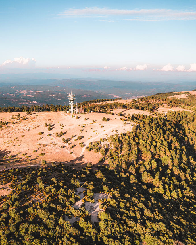
And here we are! We are at the foot of the Hertzian antenna of Mourre Nègre, at 1125 m. And how lucky! A pure sky blue lets us contemplate the horizon of the Alps to the Mediterranean, from Mont Ventoux to Sainte-Victoire, from the Monts du Vaucluse to the Alpilles…
All the effort it took to get here is suddenly forgotten.

Look up!
It’s easy to recognise the peregrine falcon with its yellow eyes and large round head… It’s a rare migratory bird of prey species that can be seen at these heights from March to October.
Lines and landscapes

Tours and detours
And afterwards? Meet under the pergola at Restaurant de l’Ormeau. Friendliness, authenticity, simplicity, local flavours… it’s a perfect place to increase your knowledge of the terroir.
On the way back, we focus on all the landscapes shaped by time, erosion and human activity. The limescale fragments were formed by deposits shaping the thickness of the soils, the torrents having carved out their bed. Farming and forestry structured the spaces. All along the route nature reveals the fundamental connection that links the show that we have before our eyes to its origins.
Whereas in the woody areas, Aleppo pines and the garrigue are dominant, Mediterranean cultivation marks the identity of the land further to the south.
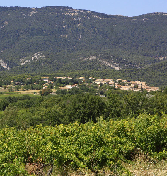
Going back down towards the village, fruit trees, olive trees and vines stretch out before us as far as the eye can see. Here viticulture has shaped one of the vital features of these lands.
Apart from the great exercise, this walk is the story of a fascinating history that paint a portrait of an endearing, rich territory.
Practical info

Find the route and all the practical information about the itinerary

Download the PDF file for the route

The 8 may 1945 car park, down from the Town Hall