
Bédoin
TV16 - Montée sèche
TV16
Route
Round trip
Difficulty
Intermediate
Duration
3h03
Distance
9km
Positive elevation gain
1436 meters
Negative elevation gain
11 meters
Altitude
Min. 448 meters
Max. 1873 meters
- circuit
- variante
- liaison
Departure / Arrival
/
Parking
profil altimétrique
Downloads
Traces GPX
Tourist service in Bédoin :
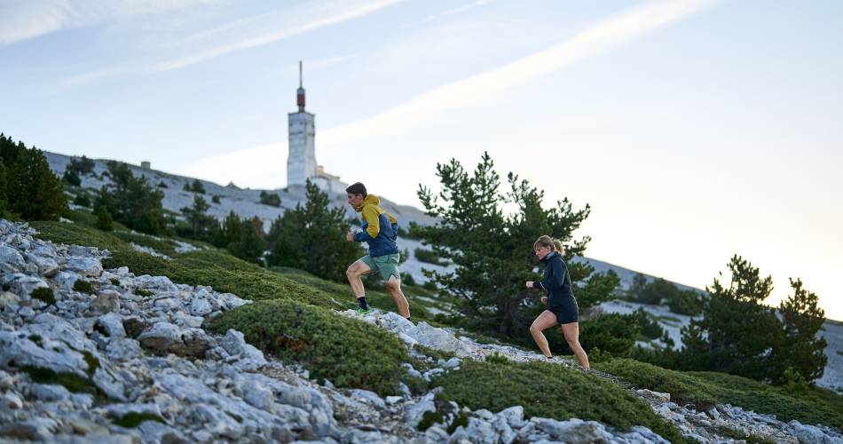
360 degree view on the Rhone delta, the Alpilles, the Luberon, the Vaucluse mountains, the Sault and Lure plateau, the Alps chain and the Dentelles de Montmirail Climbing with changes of slopes and last third often cold and windyTo note
 If you want to report a problem on your hike (marking, maintenance, danger...), let us know on Suricate: sentinels.sportsdenature.fr
Access to the massifs
Respect the regulations preserving protected natural areas – find out about restrictions to accessing the massifs during fire risk periods, from 15 June to 15 September.
Before heading out, check the website
Respect the regulations preserving protected natural areas – find out about restrictions to accessing the massifs during fire risk periods, from 15 June to 15 September.
Before heading out, check the website
In brief
Downloads
Contact
Ventoux Provence TourismeTel : View number 04 90 65 63 95
E-Mail : bedoin@ventouxprovence.fr
Website : https://www.ventouxprovence.fr
Guided hikes
This page was produced with the help of theOffice de tourisme Ventoux Provence Tourisme