
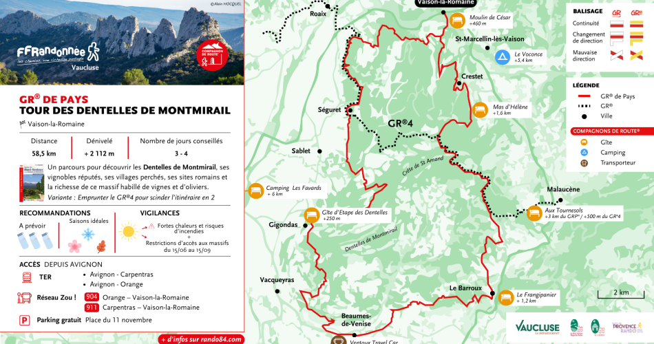
Vaison-la-Romaine
GR® de Pays: Around the Dentelles de Montmirail
Route
Two way loop
Difficulty
Intermediate
Duration
6d
Distance
60km
Positive elevation gain
2124 meters
Negative elevation gain
2125 meters
Altitude
Min. 85 meters
Max. 603 meters
- circuit
- variante
- liaison
Departure / Arrival
Vaison la Romaine / Vaison la Romaine
Parking
Place du 11 novembre, facing the tourist office
Balisage
GR® de Pays markings in both directions
profil altimétrique
Tourist service in Vaison-la-Romaine :
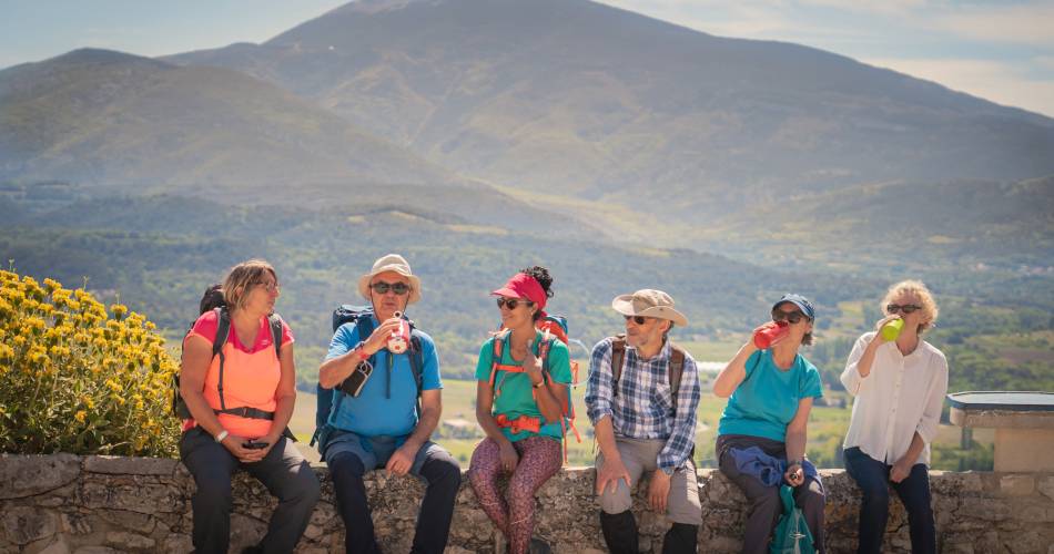
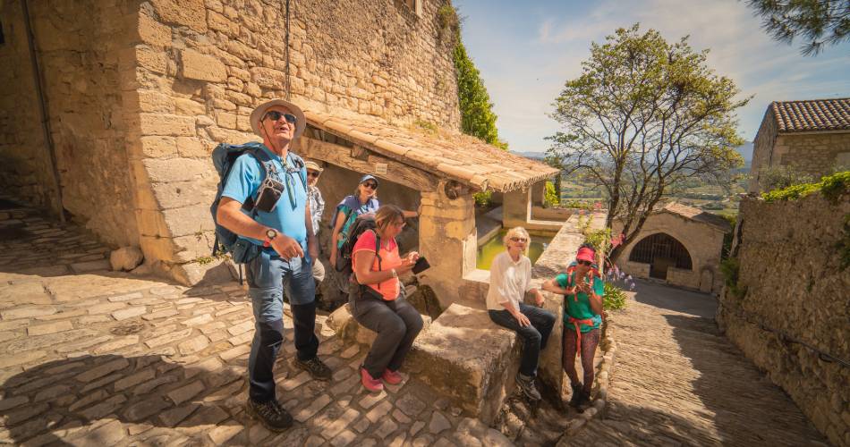
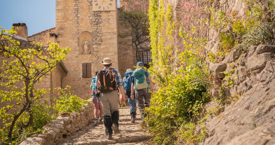
An itinerant trip that can be done in 6 days, covering a total of 10km per day, or in 3 days for practiced sportsmen (20km/ day). A course combining the discovery of the Dentelles de Montmirail, its famous vineyards, its hilltop villages, and Roman sites.
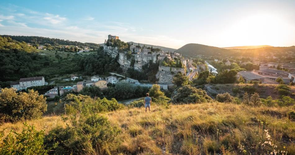
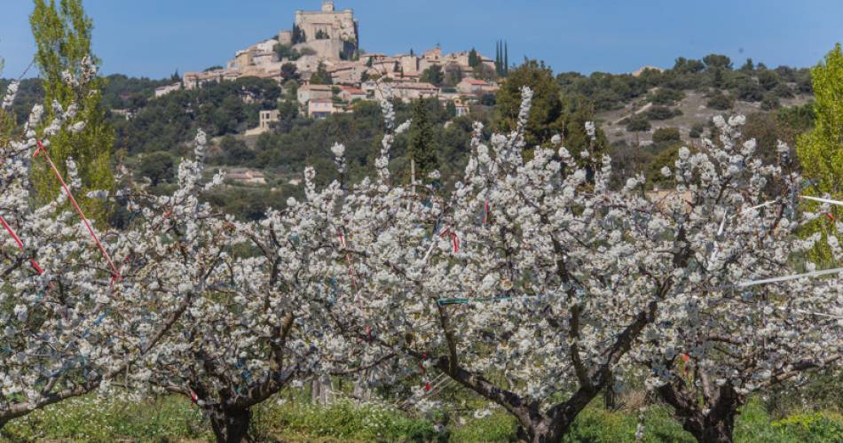
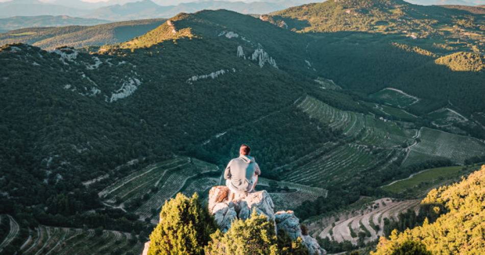
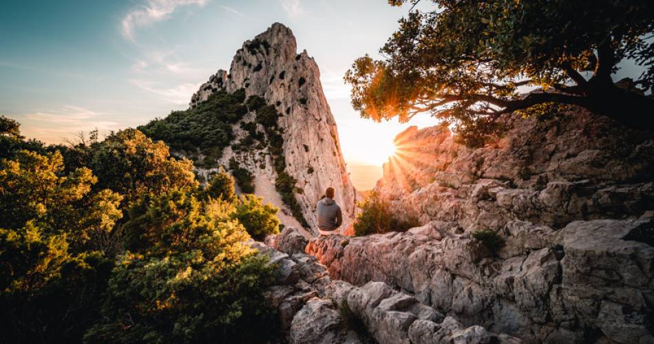
This route offers multiple viewpoints showing the geological formations, as well as the chance to experience multiple villages nestled at the bottom of this vigorous hilly area. Three lines of standing stones make up the Dentelles de Montmirail massif, and the water is drained by "vallats" (streams) that nourish the fields of crops, planted with vines and olive trees.
Go to the route
public transportation
By train Lines TER - serving Carpentras and Orange.
By Bus, Zou network
Line 4 Orange - Vaison la Romaine
Line 11 Carpentras - Vaison la Romaine
Trans'COVE bus
Line J Carpentras - Gigondas.
Line A Carpentras - Beaumes-de-Venise.
By Bus, Zou network
Line 4 Orange - Vaison la Romaine
Line 11 Carpentras - Vaison la Romaine
Trans'COVE bus
Line J Carpentras - Gigondas.
Line A Carpentras - Beaumes-de-Venise.
recommended parking
Place du 11 novembre, facing the tourist office
road access
From the A7, Exit Bollène or Orange and Direction Nyons - Vaison la Romaine.
To note
- A 3 or 6-day trip, covering either 10 or 20km per day.
- This itinerant route is best suited to spring and autumn.
- Prepare for your outing. Pack good walking shoes, a bottle of water, and clothes adapted to the weather.
 If you want to report a problem on your hike (marking, maintenance, danger...), let us know on Suricate: sentinels.sportsdenature.fr
Access to the massifs
Respect the regulations preserving protected natural areas – find out about restrictions to accessing the massifs during fire risk periods, from 15 June to 15 September.
Before heading out, check the website
Respect the regulations preserving protected natural areas – find out about restrictions to accessing the massifs during fire risk periods, from 15 June to 15 September.
Before heading out, check the website
In brief
- A Provençal itinerary which evolves according to the seasons.
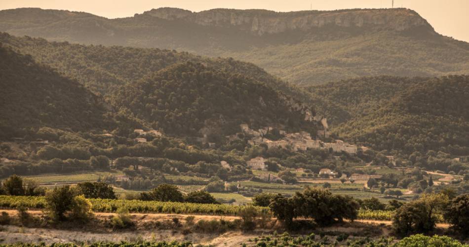
- Views of the Côtes du Rhône vineyard and villages famous for their wines: Gigondas, Vacqueyras, Beaumes de Venise, Séguret
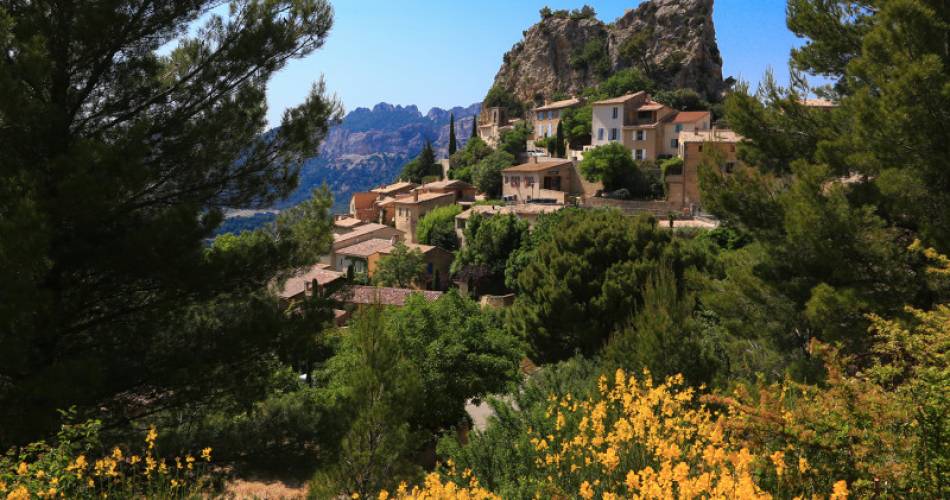
- Hilltop villages that look just like Provencal nativity scenes: Séguret, le Crestet, La roque Alric
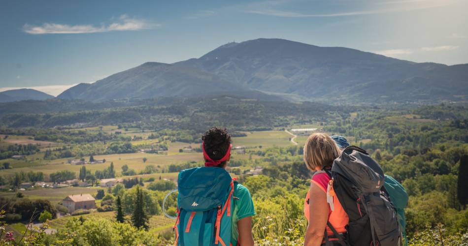
- Panoramic views of Mont Ventoux, steep limestone rocks, terraced vineyards and sheltered valleys.
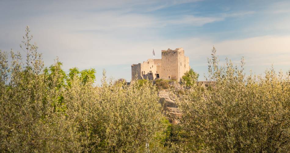
- a remarkable historical and geological heritage to discover: Vaison la Romaine, a medieval and Roman city, the castle of Barroux, Plateau des courrens, Notre Dame d'Aubune, Rocher du Rocalinaud
Contact
Fédération Française de Randonnée de VaucluseTel : View number 04 28 70 27 29
Website : https://boutique.ffrandonnee.fr/autour-du-mont-ventoux-et-des-dentelles-de-montmirail
Guided hikes
This page was produced with the help of theVaucluse Provence Attractivité