Aurel
Long Distance Mountain Bike Trail, Stage 4 – From Aurel to Saint-Saturnin-les-Apt
Tourist service in Aurel :
Here you find yourself on the Plateau de Sault, which is a landscape make up of vast open plains, shaped by fields of grains, grasses (small spelt) and lavender.
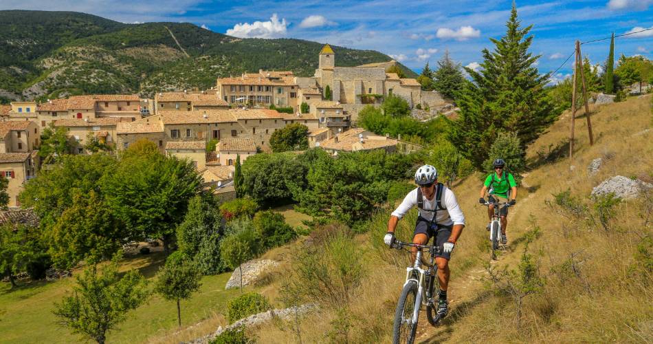
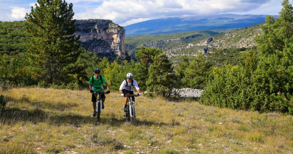
From Aurel, this fast-moving route, which offers little in the way of difficulty, will lead you to Sault and its racecourse, the highest in France (800 m), through woods and open spaces. It’s then an easy descent towards Monieux followed by one of the highlights of this long distance trail: the Nesque River Canyons. A superb path climbs up towards the Vaucluse mountains where you’ll enjoy an unforgettable view of the Gorges, one of the world’s most stunning canyons.
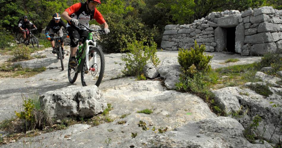
This long but extremely beautiful stretch boasts fabulous single-track trails through exceptional scenery. The trail through this remote and little frequented part of the Vaucluse mountains will eventually lead you to the Luberon Natural Regional Park. You’ll pass through a place known as Savouillon, after which you'll start to notice ancient stone water tanks (aiguiers), an extraordinary and typical feature of this region. The trail then descends towards Saint Saturnin-les-Apt, through the abandoned hamlet of Travignon, following a succession of paths that alternate between challenging and fast.
This long but extremely beautiful stretch boasts fabulous single-track trails through exceptional scenery. The trail through this remote and little frequented part of the Vaucluse mountains will eventually lead you to the Luberon Natural Regional Park. You’ll pass through a place known as Savouillon, after which you'll start to notice ancient stone water tanks (aiguiers), an extraordinary and typical feature of this region. The trail then descends towards Saint Saturnin-les-Apt, through the abandoned hamlet of Travignon, following a succession of paths that alternate between challenging and fast.

Equipment
- Charging station for 2 electric wheels
- Charging stations for electric vehicles
Duration: 0 h
Languages spoken
- French
Contact
Long Distance Mountain Bike Trail, Stage 4 – From Aurel to Saint-Saturnin-les-Apt84390 Aurel
Tel :
View number
04 90 80 47 00
Website : https://www.provence-a-velo.fr/
Facebook : https://www.facebook.com/OTI-Ventoux-Sud-1387460531503903/
Website : https://www.provence-a-velo.fr/
Facebook : https://www.facebook.com/OTI-Ventoux-Sud-1387460531503903/
Coordinates
Longitude : 5.426675Latitude : 44.12971
> Getting there by public transport
This page was produced with the help of theOffice de Tourisme Intercommunal Ventoux Sud