
Villars
La Bruyère, the sensitive area!
Route
Loop
Difficulty
Very easy
Duration
0h27
Distance
2km
Positive elevation gain
69 meters
Negative elevation gain
73 meters
Altitude
Min. 312 meters
Max. 384 meters
- circuit
- variante
- liaison
Departure / Arrival
La Bruyère car park at the edge of the Les Trécassats road, 1.5 km east of Villars (panel before the holiday centre / La Bruyère car park at the edge of the Les Trécassats road, 1.5 km east of Villars (panel before the holiday centre
Parking
La Bruyère car park at the edge of the Les Trécassats road, 1.5 km east of Villars (panel before the holiday centre
profil altimétrique
Tourist service in Villars :
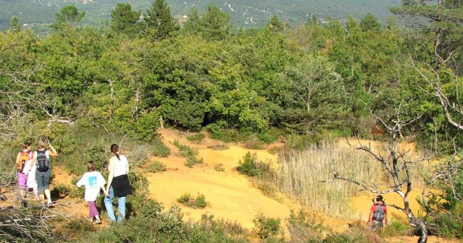
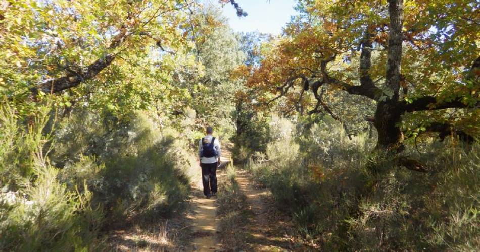
It’s a short walk in a massif classed as a sensitive natural space, that’s rich in species that are as rare as they are seen.
Once on the small bucolic La Bruyère car park, go behind the information panel about the ENS (natural sensitive space) and take the path that goes slightly to the left. At the first crossroads, go right and gradually go up via the path (GR). Continue to the top of the hill. Leave a track go off to the right and reach the “Trou des Américains” crossroads (signpost).
1 – Go right on the path that weaves in and out of the heather and get to the waterhole (explanation panels). Continue beyond it by taking the copper red-coloured path. Do not miss the path that goes to the right further down. Continue the down the slope straight ahead. Directly below the road, head left then come out on the right onto the road.
2 – Take the road to the right , let the PR go off to the left and continue straight ahead. Pass the entrance to the holiday centre and climb the path to the right to come back to the departure point.
Go to the route
public transportation
From the Apt bus station, take line 916 of the Zou Bus network (Apt – Sault, Moulin à Huile stop).
recommended parking
La Bruyère car park at the edge of the Les Trécassats road, 1.5 km east of Villars (panel before the holiday centre
road access
9 km north of Apt, via the D900, D943, D111and VC of Les Trécassats.
To note
- Make sure you stay on the trails and paths; the site of La Bruyère is highly sensitive to erosion, trampling and species being disturbed.
- Do not pick or take anything (flora, ochre).
- This natural sensitive space (ENS – espace naturel sensible) is an exceptional territory. Please respect it.
 If you want to report a problem on your hike (marking, maintenance, danger...), let us know on Suricate: sentinels.sportsdenature.fr
Access to the massifs
Respect the regulations preserving protected natural areas – find out about restrictions to accessing the massifs during fire risk periods, from 15 June to 15 September.
Before heading out, check the website
Respect the regulations preserving protected natural areas – find out about restrictions to accessing the massifs during fire risk periods, from 15 June to 15 September.
Before heading out, check the website
In brief
- A very easy and interesting circuit to do as a family, in a massif classed as a sensitive natural space, that’s rich in species that are as rare as they are seen.
- A nice little climb to the pond at the top called the “Trou des Américains”.
- Interesting to combine it with the Mines du Bruoux.
Downloads
Contact
Parc naturel régional du LuberonTel : View number 04 90 04 42 00
E-Mail : accueil@parcduluberon.fr
Website : http://www.luberon-apt.fr/
Guided hikes
This page was produced with the help of theParc Naturel Régional du Luberon