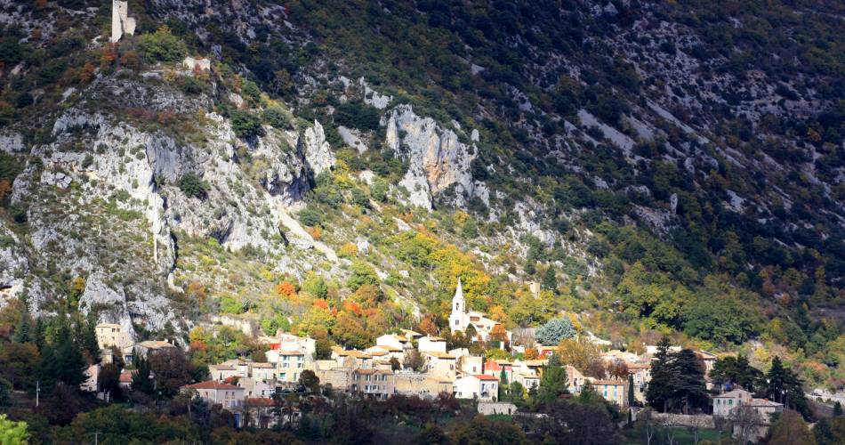
Monieux
Hiking path - The Conque Verte
Tourist service in Monieux :
An itinerary full of contrasts, with sweeping views, downhills into hidden valleys, and a farm-hamlet where time seems to have stood still. Distance: 11.5 km – Altitude change: 335 m - Time: 3 hours - Marking: white/red - yellow – white/red – Start from: St-Hubert farm in Monieux
Starting from the Saint-Hubert farm:
Go south on the road 100 m. At the curve, go to the right and go straight up to the Pas du Viguier - the beginning of the Mur de la Peste (Plague wall).
Go down on the right into fairly dense underbrush. As you come out, great view of Mont Ventoux, the Dentelles de Montmirail and the Comtat plain. Continue the descent which can be rocky at spots. Stay on the widest trail. At the base of the slope, slant to the right to reach the D 5. Cross it. 70 m further, curve to the right and stay on the main path which winds down into the vale.
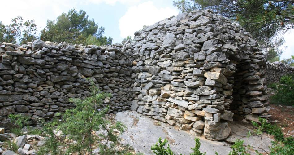
At the crossroads between the Vautorte combe on the left, and the Conque-Verte valley on the right, go up the Conque Verte valley at the back, amidst dense vegetation. The uphill grows steeper - there is a wall on the right. Stay on the big path which curves to the left, then to the right, then rises.
At the T-shaped crossroads, (there is a sign on the protection of the biotope in the Nesque river canyons), take the path on the right. It dips to the left, goes along a drystone wall, crosses the valley, curves then clibms to the Barbéris hamlet.
This is an animal-raising area, please be quiet and discreet.
Take the path into the hamlet on the right, go up slightly at first, then nearly horizontally. As face the stele, Saint-Hubert can be seen above the treetops. Take the direction south, and the trial reaches a fork. Continue straight, at the wooden cross leave the trail, which goes to the right and take the narrow path slightly offset to the left, which goes south, going up gradually, which leads to the path and to the parking lot.
Les Monts de Vaucluse à pied - Ed. FFRP 12.50 euros
Go south on the road 100 m. At the curve, go to the right and go straight up to the Pas du Viguier - the beginning of the Mur de la Peste (Plague wall).
Go down on the right into fairly dense underbrush. As you come out, great view of Mont Ventoux, the Dentelles de Montmirail and the Comtat plain. Continue the descent which can be rocky at spots. Stay on the widest trail. At the base of the slope, slant to the right to reach the D 5. Cross it. 70 m further, curve to the right and stay on the main path which winds down into the vale.
At the crossroads between the Vautorte combe on the left, and the Conque-Verte valley on the right, go up the Conque Verte valley at the back, amidst dense vegetation. The uphill grows steeper - there is a wall on the right. Stay on the big path which curves to the left, then to the right, then rises.
At the T-shaped crossroads, (there is a sign on the protection of the biotope in the Nesque river canyons), take the path on the right. It dips to the left, goes along a drystone wall, crosses the valley, curves then clibms to the Barbéris hamlet.
This is an animal-raising area, please be quiet and discreet.
Take the path into the hamlet on the right, go up slightly at first, then nearly horizontally. As face the stele, Saint-Hubert can be seen above the treetops. Take the direction south, and the trial reaches a fork. Continue straight, at the wooden cross leave the trail, which goes to the right and take the narrow path slightly offset to the left, which goes south, going up gradually, which leads to the path and to the parking lot.
Les Monts de Vaucluse à pied - Ed. FFRP 12.50 euros
Contact
Hiking path - The Conque Verte84390 Monieux