Bédoin
Long Distance Mountain Bike Trail, Stage 3 – From Bedoin to Aurel

Tourist service in Bédoin :
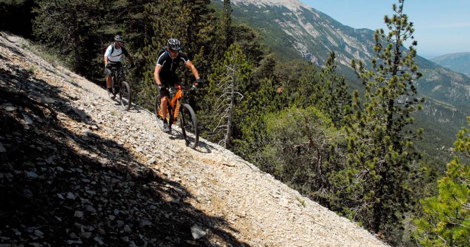
This trail is marked by a long and arduous start, extending over 15 kilometres, with an elevation gain in excess of 1,000 metres, but the breath-taking view is sure to distract you from the exertion involved.
This wide, rolling track, known as the Graviers Blancs, winds its way towards Le Chalet Reynart (1,417m), Mont Ventoux’s southern ski resort. As you’ll climb, you’ll notice that the Mediterranean forests gradually give way to traditional alpine vegetation and the famous scree, lunar landscapes of the Ventoux region. This is a protected area and a designated UNESCO biosphere reserve.
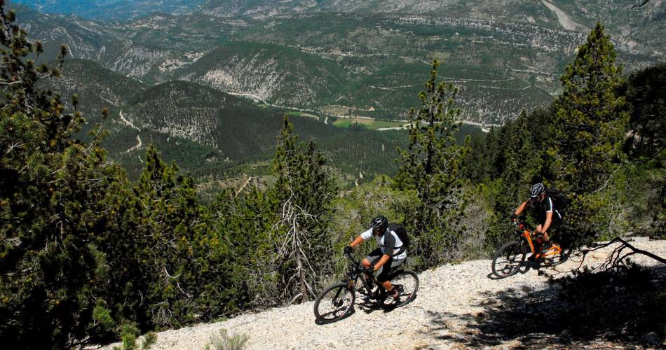
It’s then time for a downhill stretch culminating in a rather physical climb up to the highest point (1,445 m) on the trail. Once you’ve left Chalet Reynart, you’ll plunge downhill into the heart of the forest on the southern face following fast twisting paths. You’ll pass through the majestic Black Pine forest at Perrache and the refreshing “Font d’Angiou,” followed by a long climb to the Col de la Frache pass (alt. 1,327 m) towards the northern slope of Mont Ventoux. The long, steep, over-hanging path is a great Ventoux classic; it’s a fun yet challenging ride, bordered by a protected forest of one-hundred-year-old trees. The trail then changes directions, heading towards the Eastern face, with a long descent along a single track path to Aurel and the Sault Plateau.
It’s then time for a downhill stretch culminating in a rather physical climb up to the highest point (1,445 m) on the trail. Once you’ve left Chalet Reynart, you’ll plunge downhill into the heart of the forest on the southern face following fast twisting paths. You’ll pass through the majestic Black Pine forest at Perrache and the refreshing “Font d’Angiou,” followed by a long climb to the Col de la Frache pass (alt. 1,327 m) towards the northern slope of Mont Ventoux. The long, steep, over-hanging path is a great Ventoux classic; it’s a fun yet challenging ride, bordered by a protected forest of one-hundred-year-old trees. The trail then changes directions, heading towards the Eastern face, with a long descent along a single track path to Aurel and the Sault Plateau.

Contact
Long Distance Mountain Bike Trail, Stage 3 – From Bedoin to Aurel84410 Bédoin
Tel :
View number
04 90 65 63 95
E-Mail : contact@parcduventoux.fr
Website : https://www.ventouxprovence.fr
E-Mail : contact@parcduventoux.fr
Website : https://www.ventouxprovence.fr